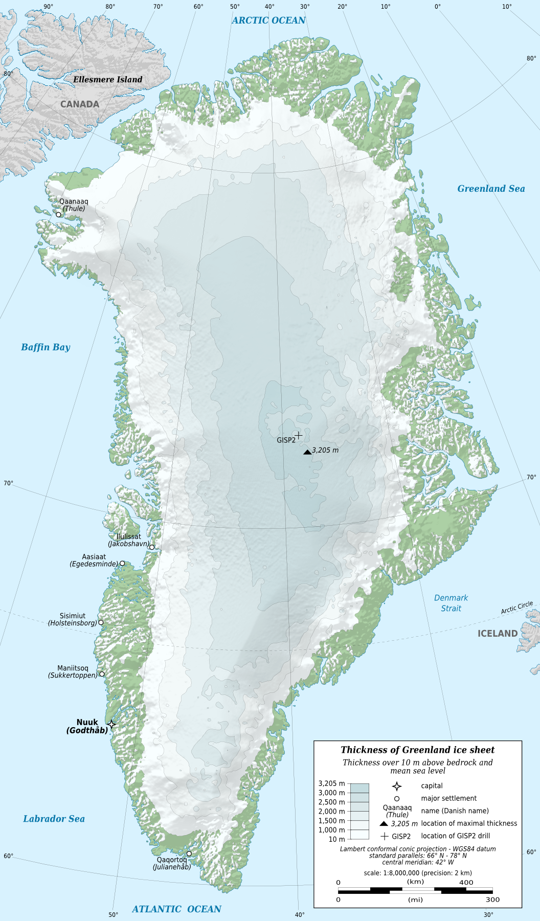
Did you know that there's an entire world hidden under Greenland's ice? This massive frozen blanket has been there for millions of years, and it's absolutely huge - we're talking about the second-largest ice sheet on Earth after Antarctica. It covers about 1.71 million square kilometers (660 thousand sq mi), which means roughly 79% of Greenland is under ice.
Here's something mind-blowing: this ice isn't just a thin layer - it's incredibly thick. On average, it's 2.1 kilometers deep (that's 1.3 miles), and in some places, it gets even thicker - over 3 kilometers (1.9 miles)! Imagine standing at the bottom of that ice sheet - you'd be looking up through ice as tall as 10 Empire State Buildings stacked on top of each other.
But what's really fascinating is what scientists have found underneath all that ice. Using special radar technology, they've discovered an amazing landscape with deep valleys and huge mountains. There's even a canyon down there that's as impressive as the Grand Canyon!
Greenland is melting. Every year, about 260 billion tonnes of ice flows into the ocean (https://www.climate.gov/greenland-ice-sheet-melting). That's a lot of ice, and it's melting faster than ever before. If all of Greenland's ice melted - all 2.85 million cubic kilometers of it - our oceans would rise by 7.42 meters (24.34 feet). Just think about what that would mean for coastal cities around the world.
Scientists are keeping a close eye on this melting ice. In the last twenty years, they've noticed it's melting much faster than before. Understanding the landscape under the ice helps them figure out how quickly these changes might happen.
Interested in learning more? Check out these books and maps: (Amazon Associate Links)
I'd love to hear what you think about this hidden landscape! Have you ever seen a glacier up close? Share your stories in the comments!


This post may contain affiliate links. As an Amazon Associate, I earn from qualifying purchases.